Show what changes when the projection changes
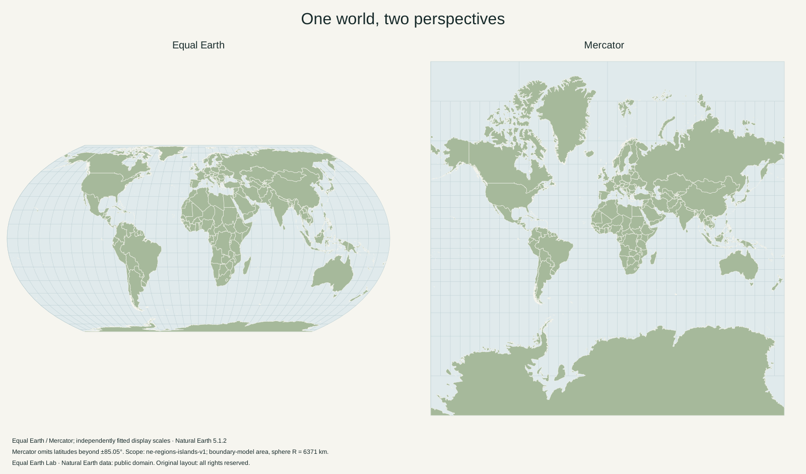
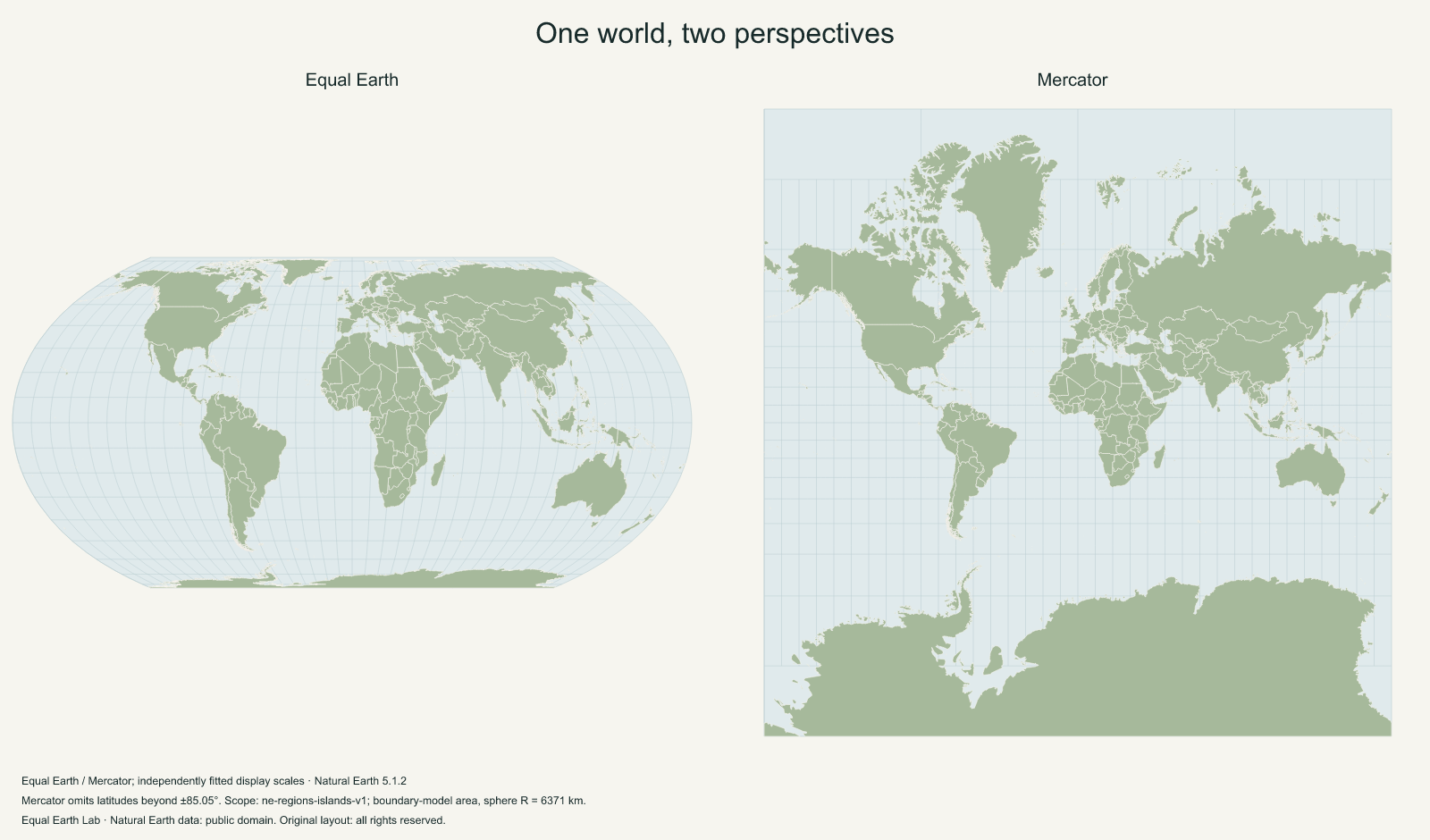
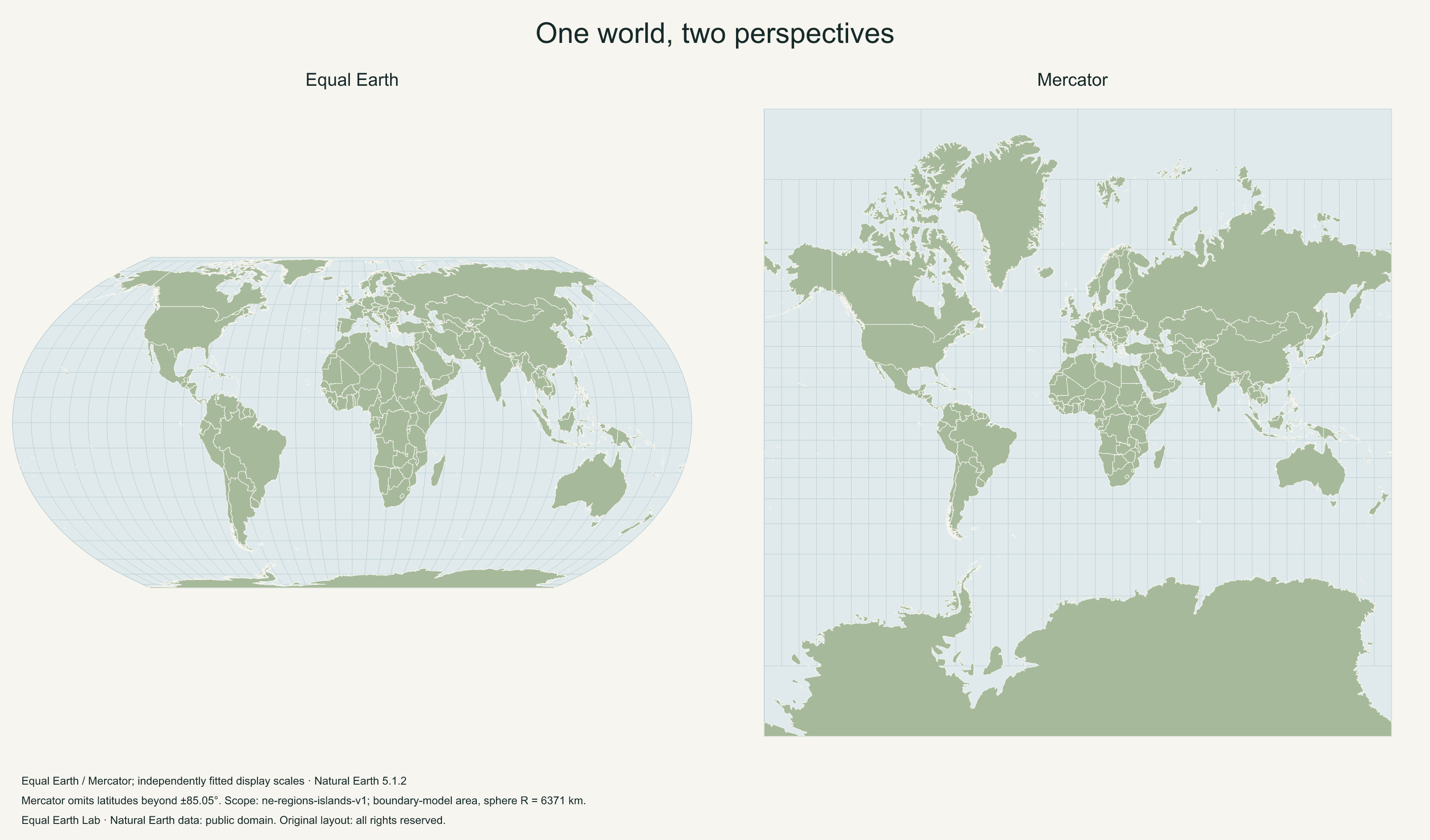
A prepared Equal Earth and Mercator composition for a slide, handout or discussion. The two views use the same boundaries and are labeled by projection.
One dataset, two different promises
This composition puts Equal Earth beside Mercator. Equal Earth preserves relative area; Mercator preserves local angles on its mathematical surface while enlarging high latitudes. The comparison guide explains those properties with examples and equations.
Both panels use the same prepared Natural Earth boundaries. This isolates the projection as the main visual difference. A comparison made from unrelated map images could also differ in geographic scope, coastline detail, crop and labels.
Explain the independently fitted frames
Each projection is fitted into its own frame. The resulting panels do not share a uniform global distance scale. Do not compare a country’s pixel area across the two panels and label that result its geographic area ratio.
A useful presentation prompt is: “How does Greenland’s size relative to Africa change within each map?” That compares two regions under each projection’s rule. For the numeric geographic ratio, use the Africa and Greenland page, which reports a consistent boundary-model calculation and provides a shared-scale silhouette view.
Use the composition in a slide or handout
PNG provides a single image you can place in presentation software. The larger version supports larger placements. SVG keeps the Atlas boundaries as vectors in compatible editors, and PDF provides the prepared print sizes listed below. This download is a map composition, not an editable PPTX slide deck.
Keep the source caption and projection labels readable in the final placement. If the two maps become too small on a slide, use one map at a time or place the comparison in a handout. Shrinking a world map and increasing its label count are usually competing choices.
Change the composition
The map maker offers a Presentation comparison template with your choice of the three supported projections. Select a different center, title, orientation or basemap there. Physical-relief exports contain embedded raster terrain with vector boundary overlays.
For a quiet background to annotate, choose the blank world map. For a single reference view, choose the labeled world map. The map-use guide covers printing, resizing and a concise source note.
Download files
1600 × 940 px · English · 2.68 MB
1600 × 940 px · English · 0.39 MB
3200 × 1880 px · English · 0.83 MB
297 × 210 mm · English · 0.92 MB
420 × 297 mm · English · 0.92 MB
279 × 216 mm · English · 0.92 MB
File verification and license details
Natural Earth data is public domain. Original layout: Original layout: all rights reserved.
Boundary version: ne-5.1.2-lab-1. Files retain a visible source caption and map metadata.
- presentation-vector
9f12adb4f00bbf5239307b24faa24c35e7d6a1b8c64b38e6f698fa9288f3e069 - presentation-1600
fa6ce4fe91b6f3cbc06f7c734a8693be76e62815430847caeb74dcd634fdca6b - presentation-3200
88a49f7dceab5f06ea4a8c6c0bebf7fa3653d02a22f314b90f54359cf932fcec - presentation-a4
e32cb78cada5c3c71c3d492cbd0b3c879ad1b270249c18b215b1660c49a95dd5 - presentation-a3
2a261853c65b45d73c008eb5df34098e8f936a3b7427a66f6339837f4a4b6828 - presentation-letter
f7d43c6e22c4760b33b29467f9ab5dde774a1ef08574cc359187596af1640cfc
Sources & further reading
Map calculations use the fixed dataset described in our methodology.